FEMA Map Identifies Parts of Indiana as Possible Nuclear Targets
It's not exactly fun to think about, but with everything going on in the world, the thought of a nuclear war threat is on a lot of minds. People want to know, “Should we be worried about a nuclear attack?” And more specifically, “Should Hoosiers be concerned?”
What an Old FEMA Map Reveals About Potential Indiana Targets
You might be surprised to learn that Indiana, while not a major population center or home to a large military base, could still be on the radar, at least according to an old FEMA (Federal Emergency Management Agency) map that's making the rounds again.
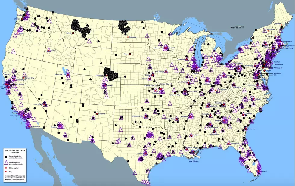
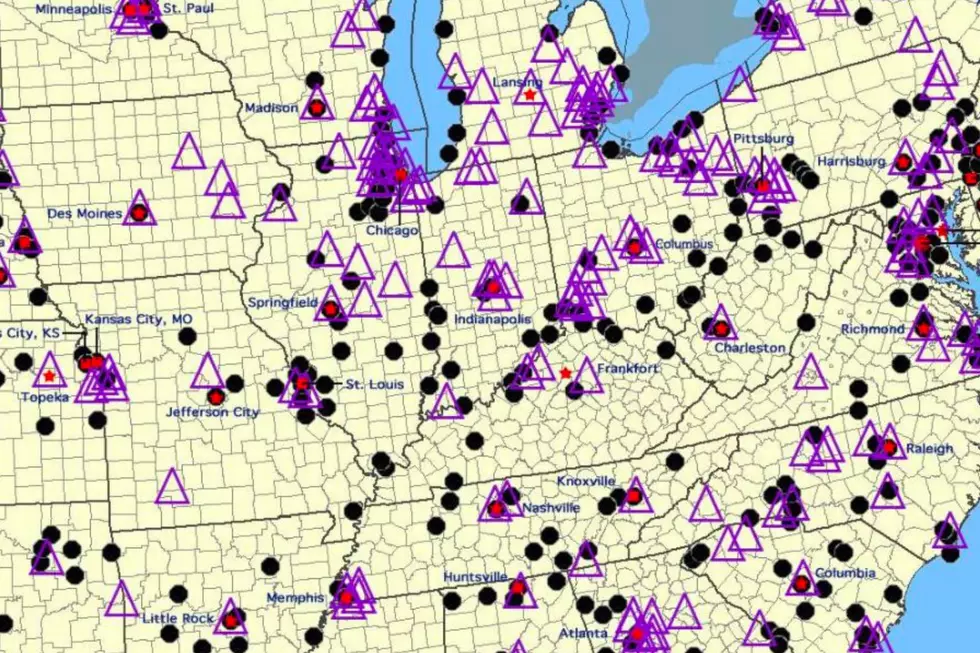
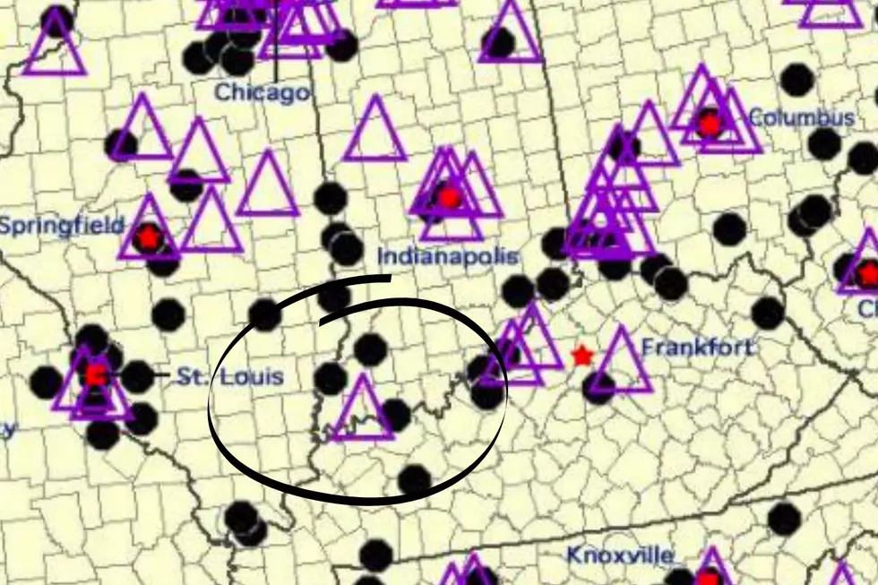
This map, originally released in 2015 by FEMA, highlights areas in the U.S. that could be targeted in the event of a nuclear strike. It’s divided into two types of threat zones: purple triangles for a limited first-strike scenario (around 500 missiles), and black dots for a full-scale war (up to 2,000 missiles).
Is Indiana Really in Danger?
While Indiana isn't as lit up as the East Coast, we’re definitely not in the clear either. In fact, there’s a purple triangle and several black dots uncomfortably close to us here in Southern Indiana. No, Evansville doesn’t have a giant bullseye on it, but we’re also not completely out of the picture.
What Hoosiers Should - and Shouldn’t - Worry About
Before you panic, let’s keep this in perspective. This map is a decade old, and a lot can change in that time. Plus, experts aren’t exactly sounding the alarm right now. So while it’s interesting—and maybe a little unsettling—to see Indiana pop up on this kind of map, there’s no reason to lose sleep over it.
18 Harsh Realities of Life in Indiana
Gallery Credit: Bobby G.
Most Hackable PIN Numbers in Indiana
Gallery Credit: Travis Sams
More From My WJLT 105.3