70 MPH Winds Possible with Southern Indiana and Western Kentucky Storms
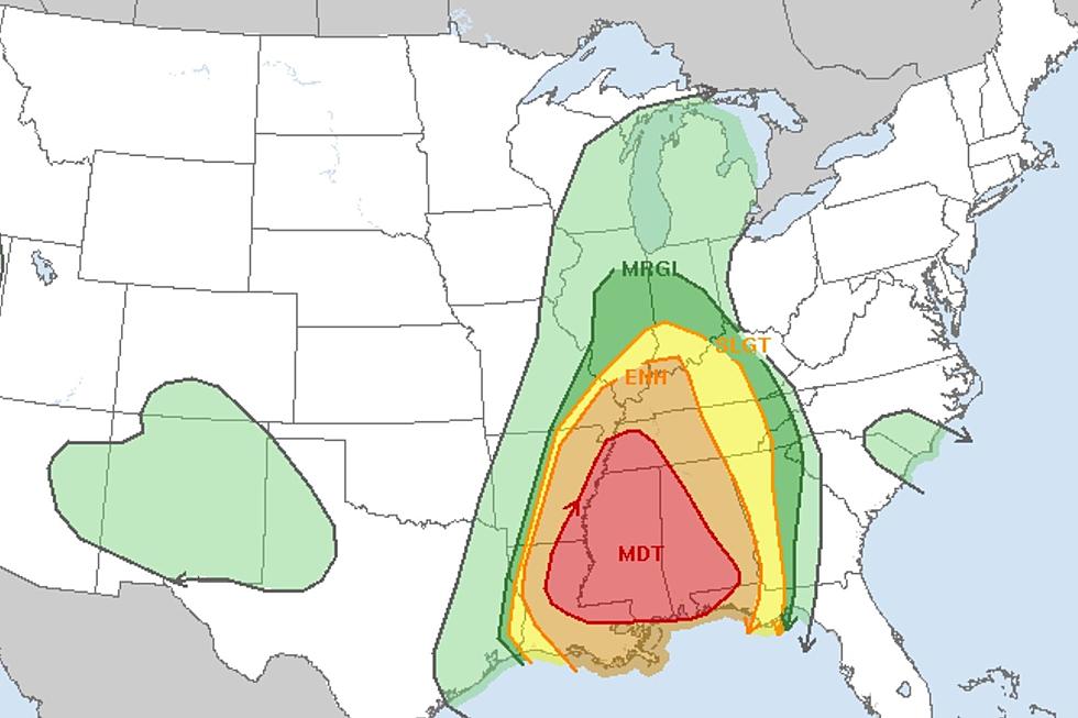
The National Weather Service has been forecasting severe weather for southern Indiana and western Kentucky for today (Wednesday, March 30th) since late last week going as far as to place most of the area under a slight risk (level two of five on their severe weather scale) for damaging winds, hail, and the possibility of a tornado. The exception was counties in southwestern Kentucky just on the fringe of our listening area. Those counties were placed under an enhanced risk. As the storms start to make their way closer to the area, that enhanced risk has now spread further north.
Severe Weather Outlook for Southern Indiana and Western Kentucky
Around 11:30 AM Central, the National Weather Service upgraded all of western Kentucky, as well as Vanderburgh, Posey, Warrick, Spencer, the eastern portion of Perry, and the southern portion of Gibson, Pike, and Dubois counties to an enhanced risk (level three of five).
The good news is, despite the increased threat, the possibility of a tornado still remains low at 5%. However, the biggest concern, and the reason for the upgrade, is the increased risk for damaging winds which, according to Eyewitness News meteorologist, Joe Bird, has been bumped up to 30% and could result in wind speeds of up to 70 miles per hour. Check out Joe's full forecast from their midday newscast below.

National Weather Service Severe Weather Risk Scale
The National Weather Service grades severe weather threats on a scale of one to five with one being "Marginal" and five being "High." While the term, "Slight," makes it feel as if the risk isn't great or a for-sure thing, it is a couple of steps up from just a few routine thunderstorms rolling through the area, and you should have your family prepared to go to wherever your save space happens to be inside your home should you need it.
Of course, in the event things get bad to the point where you and your family may be in danger, we will simulcast coverage from our media partners at Eyewitness News. Be sure to have our app on your phone to receive notifications and listen live in the event that happens.
[Source: National Weather Service on Twitter]
TIPS: Here's how you can prepare for power outages
KEEP READING: Get answers to 51 of the most frequently asked weather questions...
More From My WJLT 105.3


